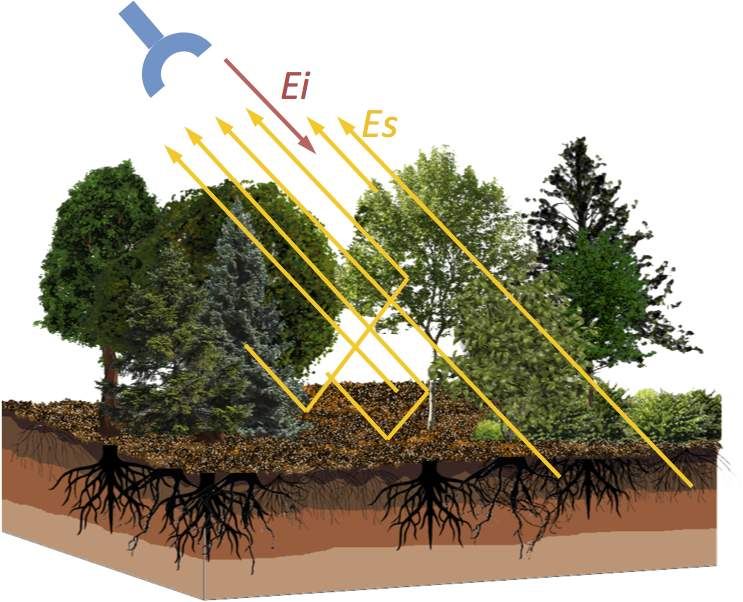
The goal of traditional remote sensing systems has been retrieval of surface, subsurface, and above-ground properties of the Earth. Electromagnetic imaging, in general, and radar remote sensing, in particular, are key components of an effective exploration and observation strategy, due to the strong relationships of the measurements with geometric and compositional properties of the observed landscape and object.
Electromagnetic scattering from rough surfaces (e.g., soil, ice) and from random media (e.g., forests) are treated as the building blocks of radar remote sensing. Layered rough surfaces are of particular interest, because they are representative models for many naturally occurring surface and subsurface structures such as layered soil and multi-year ice. Current research within MiXIL is focusing on the development of fast and accurate forward models for electromagnetic scattering by layered random rough surfaces and the corresponding inversion algorithms capable of accurately retrieving the subsurface parameters.

A forward model of scattering from discrete random media representing the root structures and other inhomogeneities is required to study their impact on the evaluation of backscattering cross section. (Duan & Moghaddam, 2011)
Publications
- Sadeghi, M., Tabatabaeenejad, A., Tuller, M., Moghaddam, M. and Jones, S.B., “Advancing NASA’s AirMOSS P-Band Radar Root Zone Soil Moisture Retrieval Algorithm via Incorporation of Richards’ Equation,” Remote Sensing, vol. 9, no.1, 2017.
- A. Tabatabaeenejad, M. Burgin, X. Duan and M. Moghaddam, “P-band radar retrieval of subsurface soil moisture profile as a second-order polynomial: First AirMOSS results”, Geoscience and Remote Sensing, IEEE Transactions on 53(2), pp. 645-658. 2015.
- Tabatabaeenejad, A., Duan, X. and M. Moghaddam, “Coherent Scattering of Electromagnetic Waves from Two-Layer Rough Surfaces Within the Kirchhoff Regime,” IEEE Trans. Geoscience and Remote Sensing. vol 51 no 7, July 2013, pp 3943-3953. doi:10.1109/TGRS.2012.2229391.
- X. Duan, M. Moghaddam, Vector Electromagnetic Scattering From Layered Rough Surfaces With Buried Discrete Random Media For Subsurface And Root-Zone Soil Moisture Sensing, Proc. IEEE-IGARSS, July 2011, Vancouver, BC, Canada. (Winner of Student Paper Contest First Prize)
- X. Duan, M. Moghaddam. Bistatic Vector 3-D Scattering From Layered Rough Surfaces Using Stabilized Extended Boundary Condition Method’,IEEE Transaction on Geoscience and Remote Sensing, vol. 50, no. 1, pp. 87 – 103, 2012
- A. Tabatabaeenejad, M. Burgin, and M. Moghaddam, Potential of L-band Radar for Retrieval of Canopy and Subcanopy Parameters of Boreal Forests. IEEE Trans. Geosci. Remote Sensing, vol. 50, no. 6, pp. 2150-2160, June 2012.