

Sensing the Earth, from soil to space.
Radars, sensors and imaging methods that measure soil, snow, rivers and permafrost, from buried sensor networks to satellites, and bring the same physics to medicine.
From rivers to permafrost
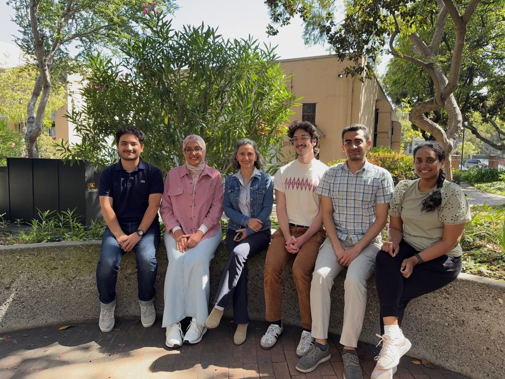


The Microwave Systems, Sensors and Imaging Lab (MiXIL), part of the Ming Hsieh Department of Electrical Engineering within the Viterbi School of Engineering at the University of Southern California carries out a diverse range of research involving microwave systems and sensors, environmental and medical imaging, electromagnetic and acoustic scattering and inverse problems, non-contact medical therapy, and ultra-low-energy wireless sensor networks.
- Research projects
- 11
- Publications
- 842+
- Members & alumni
- 38
- Years of research
- 30+


What we work on
 01 — AUTONOMOUS
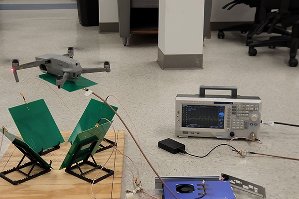
Autonomous Multi Agent Motion Tracking
In this project we are aiming to introduce an alternative method for localizing mobile antenna nodes beyond GPS, IMUs, and camera-based systems,…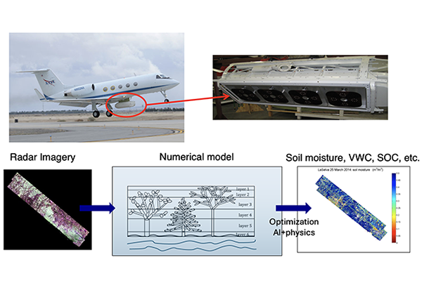 02 — SUBSURFACE
Subsurface and Subcanopy Soil Profile Characterization
Our group has established a long track record of expertise in forward and inverse scattering models for subcanopy and subsurface characterization for… 03 — ENVIRONMENTAL
Environmental Mapping
We create multi-scale environmental maps from microwave airborne and spaceborne remote sensing platforms, including SARs, GNSS-Reflectometry, and radiometers. , Our team builds… 04 — REAL-TIME
Real-Time Microwave Imaging of Thermal Therapies
We have built a GPU-accelerated 3D microwave imaging system that reconstructs tissue permittivity and conductivity in near real time from S-parameter data…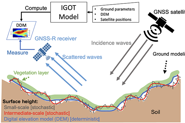 05 — GNSS
GNSS Reflectometry
We use Global Navigation Satellite System (GNSS)-reflectometry (GNSS-R) to estimate land surface properties from satellite signals, such as GPS, reflected off the…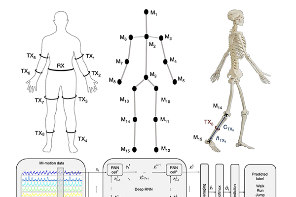 06 — MOTION
Motion Tracking using Magnetic Induction Sensors
In this project we are using magnetic induction (MI) sensors to track human body movements. This system offers a low-power, secure, and…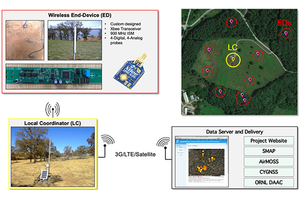 07 — SOILSCAPE
SoilSCAPE
The Soil moisture Sensing Controller and oPtimal Estimator (SoilSCAPE) technology, developed in our group, uses wireless sensor networks to collect high-temporal-resolution soil…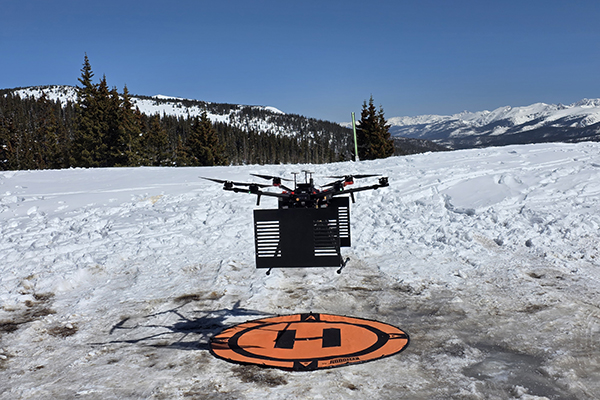 08 — SNOW
 Snow
In this project we have built a field-ready UAV based software-defined radar (SDRadar) system that measures snow depth and snow layer structure…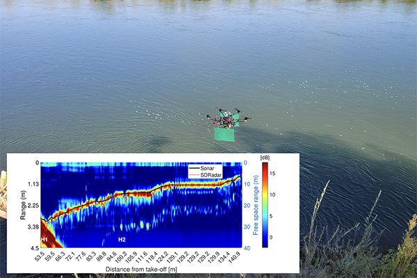 09 — BATHYMETRY
Bathymetry
River bathymetry, or submerged topography of riverbeds, is a critical variable in many hydrological, operational, and environmental applications. We have developed an… 10 — PERMAFROST
Permafrost
We have pioneered the retrieval of arctic permafrost active layer soil profile properties, such as active layer thickness (ALT) and soil moisture… 11 — SOFTWARE
Software Defined Radar
Software-defined radar (SDRadar) is a highly reconfigurable radar based on software-defined radio technology that can be adopted for different applications. Our radio-frequency…Latest from the lab
Evaluating Soil Surface Scattering Models: Perspectives From Polarimetric P-, L-, and S-Band SAR Observations
View on LinkedIn ↗ (opens in a new tab)A Merged CYGNSS Soil Moisture Product Using a Minimum Variance Estimator
View on LinkedIn ↗ (opens in a new tab)Analytical Assessment of GNSS-R Delay Doppler Map Sensitivity to Land Surface Variables Using a Physics-Based Model
View on LinkedIn ↗ (opens in a new tab)Build the next generation of microwave sensing with us.
We welcome prospective PhD students, postdocs and collaborators working on radar, remote sensing, electromagnetics and medical imaging.