

Objective
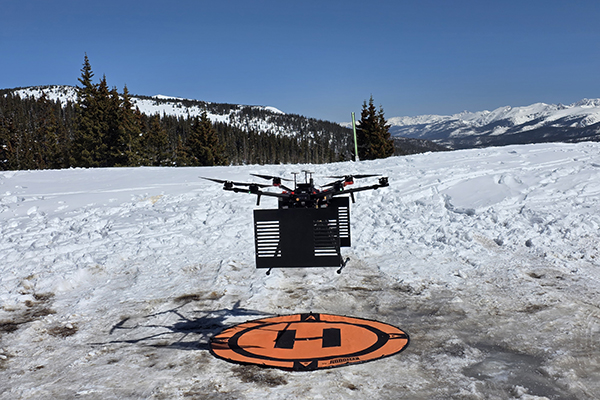
Measure the snow depth and snow layers. The goal is to estimate the snow water equivalent (SWE) and determine if an avalanche could occur. We were able to demonstrate the ability to measure the snow depth in multiple measurement campaigns and were able to observe the snow layers.
Papers
- S. Prager, G. Sexstone, D. McGrath, J. Fulton and M. Moghaddam, “Snow Depth Retrieval With an Autonomous UAV-Mounted Software-Defined Radar,” in IEEE Transactions on Geoscience and Remote Sensing, vol. 60, pp. 1-16, 2022, Art no. 5104816, doi: 10.1109/TGRS.2021.3117509.
- Melebari, Asem, Sepehr Eskandari, and Mahta Moghaddam. “Avalanche Hazard Detection Using an Ultrawideband Software-Defined Radar Mounted on a UAV.” In AGU Fall Meeting Abstracts, vol. 2024, no. 465, pp. C23C-0465. 2024.
More research
GNSS Reflectometry
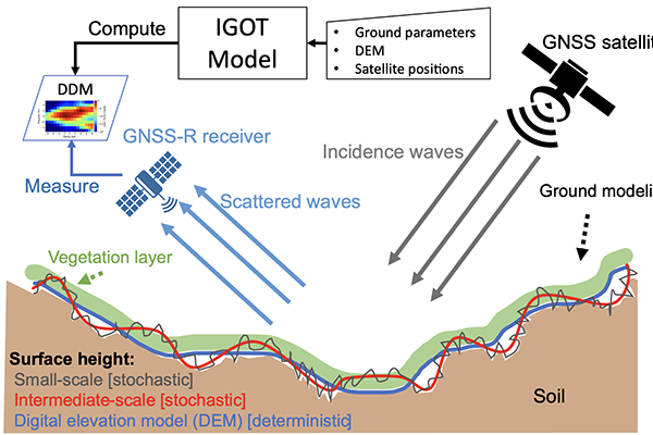
We use Global Navigation Satellite System (GNSS)-reflectometry (GNSS-R) to estimate land surface properties from satellite signals, such as GPS, reflected off the…

Software Defined Radar
Software-defined radar (SDRadar) is a highly reconfigurable radar based on software-defined radio technology that can be adopted for different applications. Our radio-frequency…

Real-Time Microwave Imaging of Thermal Therapies
We have built a GPU-accelerated 3D microwave imaging system that reconstructs tissue permittivity and conductivity in near real time from S-parameter data…